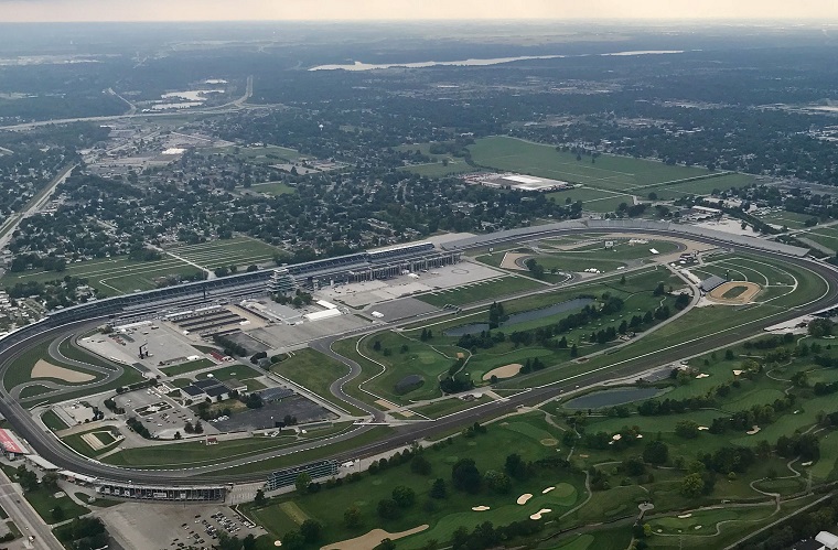

An aerial view of the Indianapolis Motor Speedway
Photo: Kim
Thanks to a joint effort by Google Maps and the Indianapolis Motor Speedway, you can now catch a track-level glimpse of what it’s like to race in the Indianapolis 500.
Right before this year’s race, a vehicle equipped with a Street View camera drove a lap around the speedway. The resulting images show a 360-degree view of the track as the surrounding stands are packed with fans waiting for the green flag to drop.
To enjoy the spectacle, all you need to do is navigate to the Indianapolis Motor Speedway in Google Maps and switch to Street View. You can also see the same images at the IMS website.
“Indy 500 Race Day is the definition of pure spectacle and pageantry,” said IMS President J. Douglas Boles. “There’s nothing quite like it, and this special project makes Race Day accessible to people around the globe 365 days a year.”
Virtual Car Shopping: Shop Click Drive makes it easy to find your next vehicle
The project was headed up by Google employee Mike Abrams, who is also a native of Indianapolis.
“At Google it’s always been our goal to help people go where they’ve never gone before. … Now, everyone can get a bit closer to the action,” said Abrams.
This interactive look at the Indy 500 begins at the start and finish line, including the track’s famous Yard of Bricks. It then takes you through all four turns, including the infamous Snake Pit on Turn 3. At each point along the 2.5-mile oval, you can rotate the view 360 degrees. This will allow you to see the grandstands, the fans, the infield, and other track details.
Tire Basics: Here’s how to maintain your tires — and when to replace them
News Sources: Indianapolis Business Journal, Indianapolis Motor Speedway